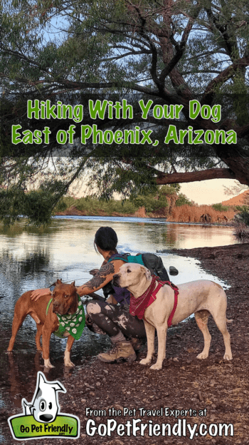
Phoenix is a giant dog friendly playground just begging to be explored. East of the city, national forest land, a wilderness area, and various state and regional parks provide great opportunities for dog friendly hiking near Phoenix!
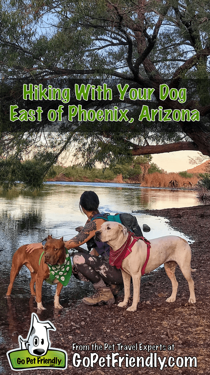
Today I’m sharing five of our favorite dog friendly hikes near Phoenix. Most of these are within an hour of downtown, and each hike has a map at the trailhead or is marked with signs along the way.
Dog Friendly Hiking Near Phoenix
Treasure Loop Trail – Lost Dutchman State Park
Lost Dutchman State Park sits on the western edge of the Superstition Mountains, an area filled with good hiking and mysterious local legends. The park is named after the “Lost Dutchman’s Mine,” a lost gold mine from the legend of Jacob Waltz, “The Dutchman.”
Waltz reportedly located the mine the 1840s, but had never shared the location when he died in 1891. Due to the the mysterious nature of these mountains, the mine still hasn’t been located.
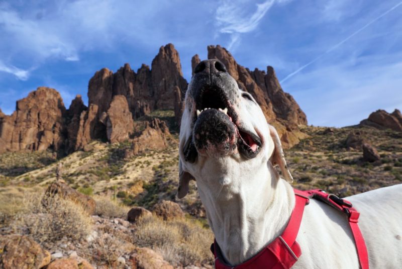
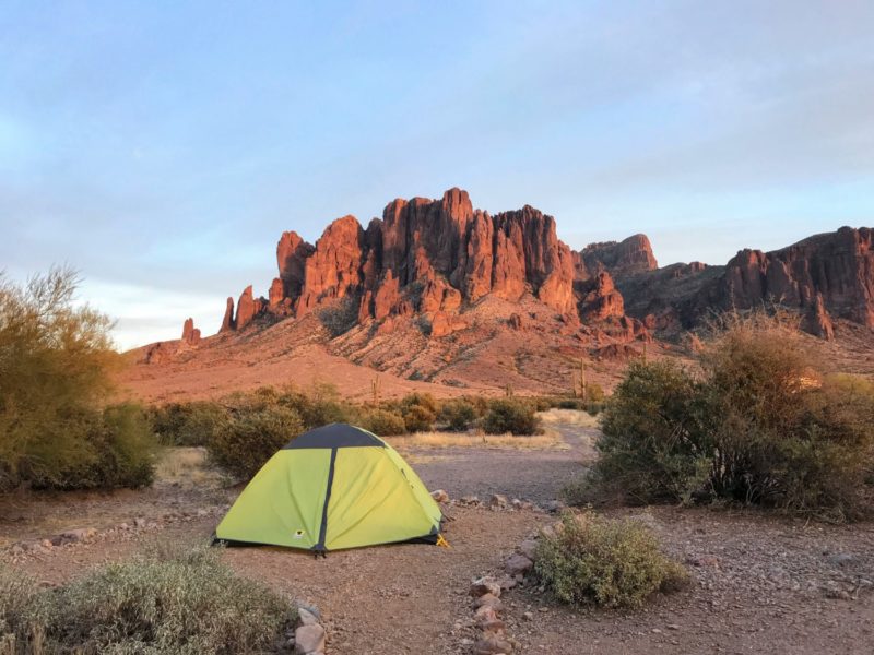
Treasure Loop Trail is an easy hike that provides a fantastic view of the mountains and the valley sprawling around behind you. With several trails that crisscross along the way, you’re able to adjust the length of your hike as you explore. Lost Dutchman also has camping available with fantastic views and easy access to the trails.
- Trailhead coordinates: 33.461140, -111.477450
- Round trip: 2.4 miles
- Difficulty: Easy
- Elevation gain: 547 feet
- Hiking traffic: Moderate
- Fees/passes needed: $10.00 per vehicle for a day pass
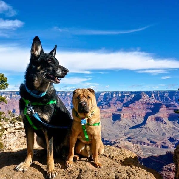
EXPLORE MORE ⇒ Visiting Grand Canyon National Park With Pets
Massacre Grounds Trail – Superstition Wilderness
Just down the road from Lost Dutchman State Park you’ll find the Massacre Grounds Trail. This trail gets it’s name from another gold mining legend. It’s said that in 1848, a group of miners were ambushed and killed here while preparing to transport their cache of gold back to Mexico.
Despite its dramatic history, Massacre Grounds Trail is a beautiful showcase of desert landscape with a mountain backdrop. This trail is especially rewarding after seasonal rains when a waterfall forms on the cliffs at the end of the trail.
The trail is well maintained and easy to follow as it wanders through cholla, prickly pear, and other desert plants. Once you pass through a fence indicating you are entering the Superstition Wilderness, the landscape gets more brushy as you make your way into the foothills. This was Herc’s favorite part of the trail — so many opportunities for sniffing lizards under the bushes!
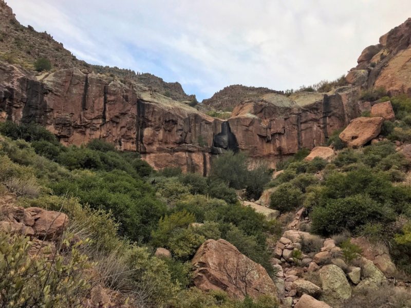
After walking up a section of smooth off-white granite, you will come to a split near the end of the trail. Left will take you onto the bluff for a beautiful view, and right will take you down to the base of the seasonal waterfall. Explore both if you have the time!
- Trailhead coordinates: 33.471510, -111.469190
- Round trip: 5.3 miles
- Difficulty: Moderate
- Elevation gain: 1,090 feet
- Hiking traffic: Moderate
- Fees/passes needed: None
- NOTE: The parking lot for this trail is located off a bumpy dirt road; it is easily manageable by car as long as you drive carefully and avoid any areas covered in water.
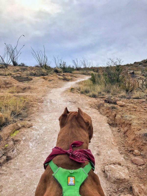
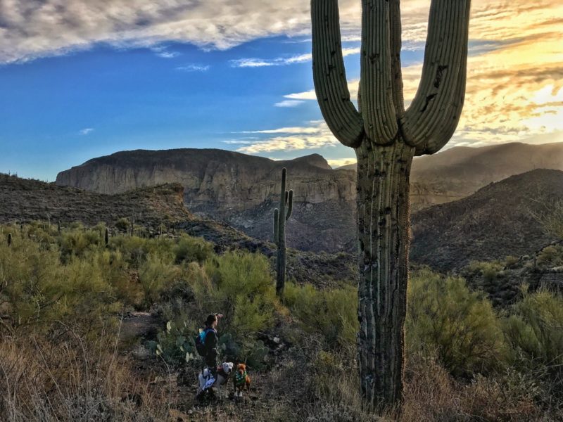
Second Water Trail – Superstition Mountains
Continuing down the dirt road past the Massacre Grounds parking lot, you’ll reach the First Water Trailhead parking area. This is a launch point for several dog friendly hiking trails near Phoenix, including one we love … the Second Water Trail.
The Superstitions offer a great many surprises, including petroglyphs, old farm equipment, and various remnants of the gold mining era. But my favorite “discovery” is the spectacular sunrise you get from Second Water Trail. It is absolutely worth the early morning wake-up!
READ MORE ⇒ 7 Essentials for Desert Hiking With Your Dog
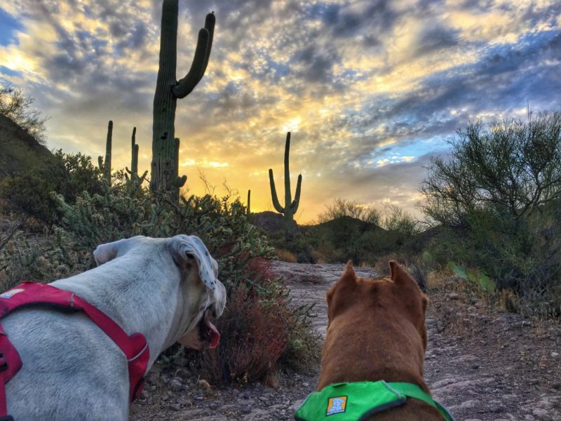
Starting your hike early also means you’ll be back before the temperatures start to climb. When hiking in the desert, always keep temperature and access to water in mind – especially with dogs. Just because there was water in the creek last time you hiked, doesn’t mean it will be there next time. So be sure you bring enough water for you and your dog.
- Trailhead coordinates: 33.480100, -111.443160
- Round trip: 6.4 miles
- Difficulty: Easy
- Elevation gain: 485 feet
- Hiking traffic: Moderate
- Fees/passes needed: None
- NOTE: The parking lot for this trail is located off a bumpy dirt road; it is easily manageable by car as long as you drive carefully and avoid any areas covered in water.
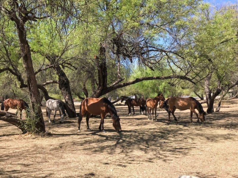
Butcher Jones Trail – Saguaro Lake
According to local legend, “Butcher” Jones was a doctor who earned his nickname after performing surgeries on his kitchen table. But don’t let that gruesome tale keep you away!
The Butcher Jones Recreation Area has a lovely beach and picnic area frequented not only by humans, but also by wild horses. Remember to keep your dog on-leash and stay at least 50 feet away from the horses.
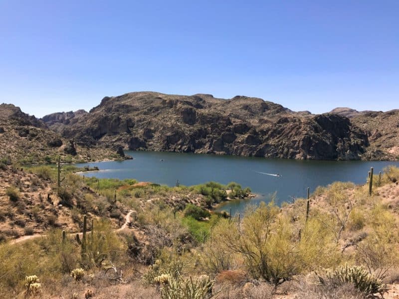
Butcher Jones Trail wanders along the edge of Saguaro Lake, a reservoir on the Salt River. Each end of this out-and-back trail connects to the lake, as do several other locations along the way.
If your dog loves water, this hike should be at the top of your list. Our hiking pace slows dramatically on this trail because Hercules insists on playing in the water whenever he catches a glimpse of it!
- Trailhead coordinates: 33.575730, -111.514430
- Round trip: 5 miles
- Difficulty: Easy to moderate
- Elevation gain: 541 feet
- Hiking traffic: Moderate to heavy
- Fees/passes needed: Tonto Daily Pass ($8.00, one per vehicle), visit the Tonto National Forest Passes page for purchase information; America The Beautiful passes are also accepted.
EXPLORE MORE ⇒ Pet Friendly Flagstaff: What To Do, Where To Stay, Places To Eat
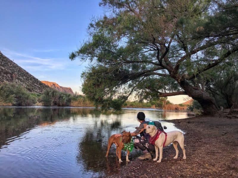
Salt River Shoreline – Lower Salt River
If you purchased a Tonto Pass to explore the Butcher Jones Trail, here’s a bonus! The Lower Salt River starts just a few miles down the road and is one of our favorite stops during warm weather, or when we don’t have enough time for a long hike.
There are several parking lots where you’ll find paths heading down to the river. From there you can follow the shoreline and splash in the water.
It is also perfectly acceptable to admire the view from a dry spot if your dog is like Cool Whip, who doesn’t like to get her dainty princess toes wet. This is also another great spot to catch a glimpse of the wild horses.
DO MORE ⇒ Tips For Teaching Your Dog How To Swim
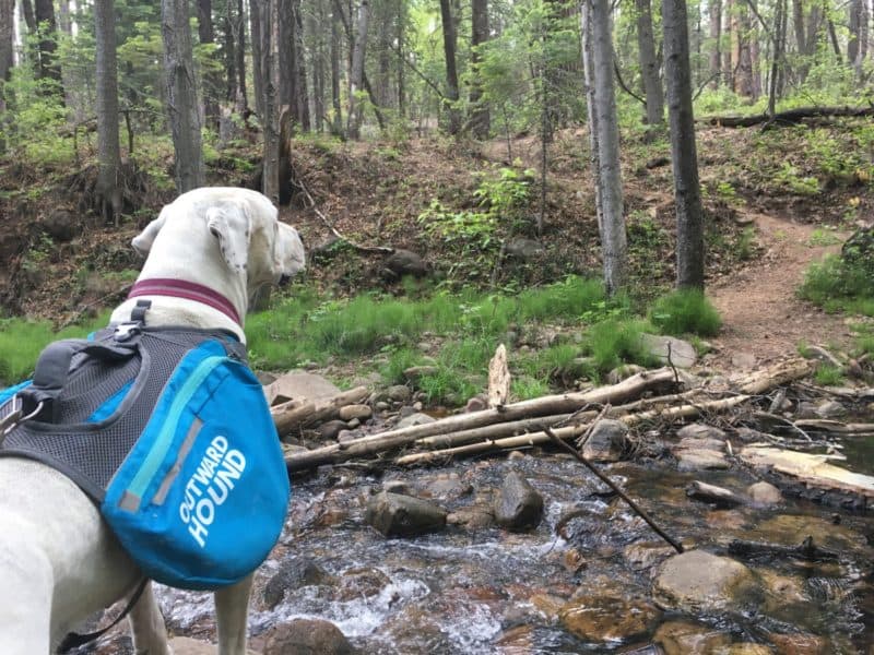
Horton Creek Trail – Tonto National Forest
Arizona is known for its stunning desert landscape, but that’s not all it has to offer! Horton Creek Trail will take you into the woods for a hike to the top of a spring-fed creek. Bring along a snack or lunch to enjoy at the top, because you’re going to want to hang out for a while!
The scenery makes this hike worth including even though it is about 2-hour drive north-east of Phoenix.
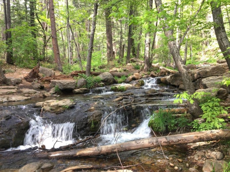
Horton Creek Trail is a relatively gradual climb as you wind your way up through the trees. The water from the spring literally gushes out from the rocks at the top, forming the creek as it runs down along the trial. Even Cool Whip enjoyed hopping through the stream on this hike!
- Trailhead coordinates: 34.339609, -111.096239
- Round trip: 7 miles
- Difficulty: Moderate
- Elevation gain: 1,145 feet
- Hiking traffic: Moderate
- Fees/passes needed: None
EXPLORE MORE ⇒ Sedona, AZ: Where To Hike, Stay & Eat With Pets
These spots for dog friendly hiking near Phoenix are just a small sampling of the fantastic dog friendly trails now available in the area. And I encourage you to venture out beyond this list!
A few other pet friendly areas for dog owners to explore include McDowell Mountain Regional Park, Usery Mountain Regional Park, Boyce Thompson Arboretum State Park, and San Tan Mountains Regional Park.
Be sure to review the pet rules at each location for leash requirements and other guidelines. I hope your dogs enjoy these adventures as much as Cool Whip and Hercules do. Happy hiking!